My drive north on the Pacific Coast Highway in California left me awestruck as I viewed the picturesque scenery along the route. This segment of my trip started in Lompoc, California, and ended in Marina, California. A friend told me I would love this drive! She was right! In this blog, I take you on my journey north along this scenic California coastline. Also, I talk about the three most spectacular scenic views of the ocean that left me in a sense of wonderment. These three views include Morro Rock, Elephant Seals, and Sunset over the Pacific Ocean.
The Journey to the Pacific Coast Highway
From Iowa to California
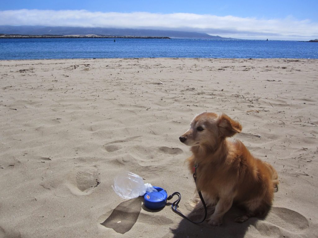
My two-week trip started in Eastern Iowa, a week earlier. Pippy, my long-haired Dachshund Pomeranian mix dog, accompanied me. In addition to my luggage and other necessities, I hauled my bicycle on the back of my Nissan Sentra. The drive from eastern Iowa to California was full of adventure and mountain scenes. I drove on Wolf Creek Pass in Colorado, which is U.S. Highway 50 through that state and picked up I-70 in Grand Junction, Colorado. Finally, I arrived in the Los Angeles area via I-15 several days later and headed north on Highway 1 to Lompoc, where I stayed with some friends for several days.
Lompoc, California
My journey north on the Pacific Coast Highway started in Lompoc, California, on September 23, 2014. Earlier that morning, I rode my bicycle through the streets of Lompoc. This gave me an opportunity to reflect on the visit with my friends. Also, I got fresh air and exercise before beginning my journey north. After saying good-bye to my friends, I left Lompoc early in the afternoon that bright, sunny day.
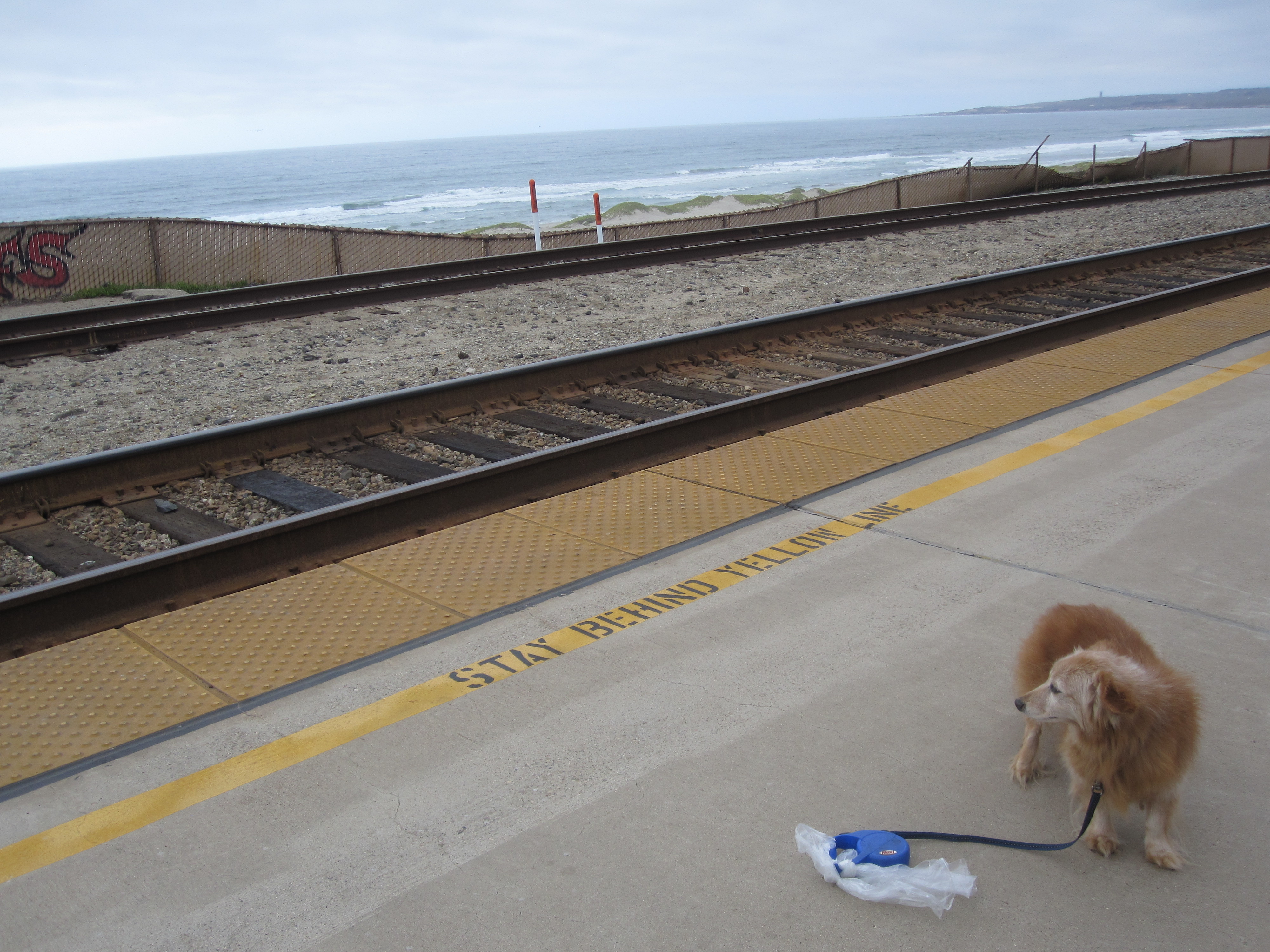
I wanted to see the ocean, so I drove to the Lompoc-Surf Amtrak station the previous day. This Amtrak station, on land owned by Vandenberg Airforce Base, is next to the ocean about seven miles west of the city of Lompoc. It is a stop for passengers to load and unload on Amtrak’s Pacific Surfliner. In addition, there is a shelter at the site. However, no buildings reside there. Unfortunately, I didn’t see any trains, but I got a glimpse of the ocean on this cloudy, cool, windy day.
Western Snowy Plover
An interesting sign stood near the vicinity of the Amtrak station. This sign explained why the beach, called Surf Beach, on the other side of the railroad tracks was closed at the time I was there. Western Snowy Plover birds nest from September to March. These birds build nests in the sands of the beaches along the California coast. The nests and the eggs are hidden and could be endangered by beach users. Therefore, Surf beach was closed during this time period. Look here for more information about the Western Snowy Plover at Surf Beach and for a photo of the bird with her eggs.
Journey to Morro Bay on Pacific Coast Highway
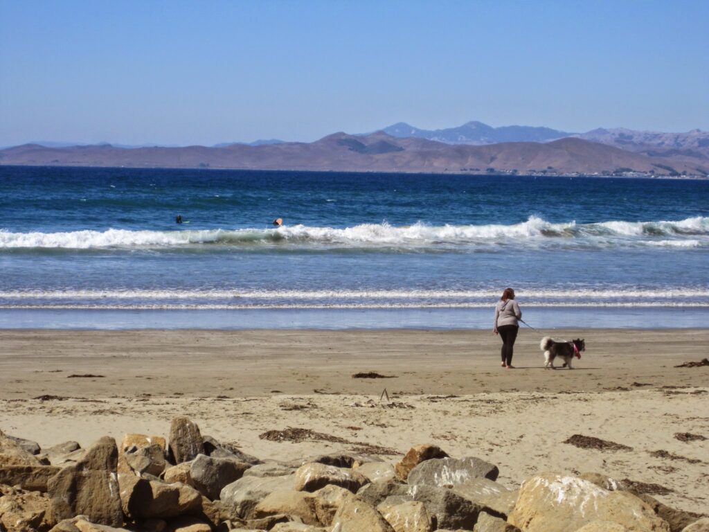
Once I left Lompoc, I drove north on the Pacific Coast Highway, also called Highway 1, and stopped at a gas station in San Luis Obispo as well as at several scenic pullouts next to the Pacific Ocean. Each view gave a new perspective and scenic view of the majestic Pacific Ocean.
Sunset was close as I approached Morro Bay. It was time to find a place to stay for the night. Did I want to stay at a motel or a campground? I stopped at a few motels but they had no rooms for pets. However, after seeing a sign for Morro Bay State Park, I decided to find out if they had a campground. They did indeed!
Morro Bay State Park
Morro Bay State Park consists of a campground, picnic areas, and hiking trails, as well as the Museum of Natural History. In addition, Morro Bay and Morro Rock are visible from the museum. Further, a marina provides access to the bay for canoeing and kayaking. A golf course also is present in the park.
Morro Bay State Park Campground
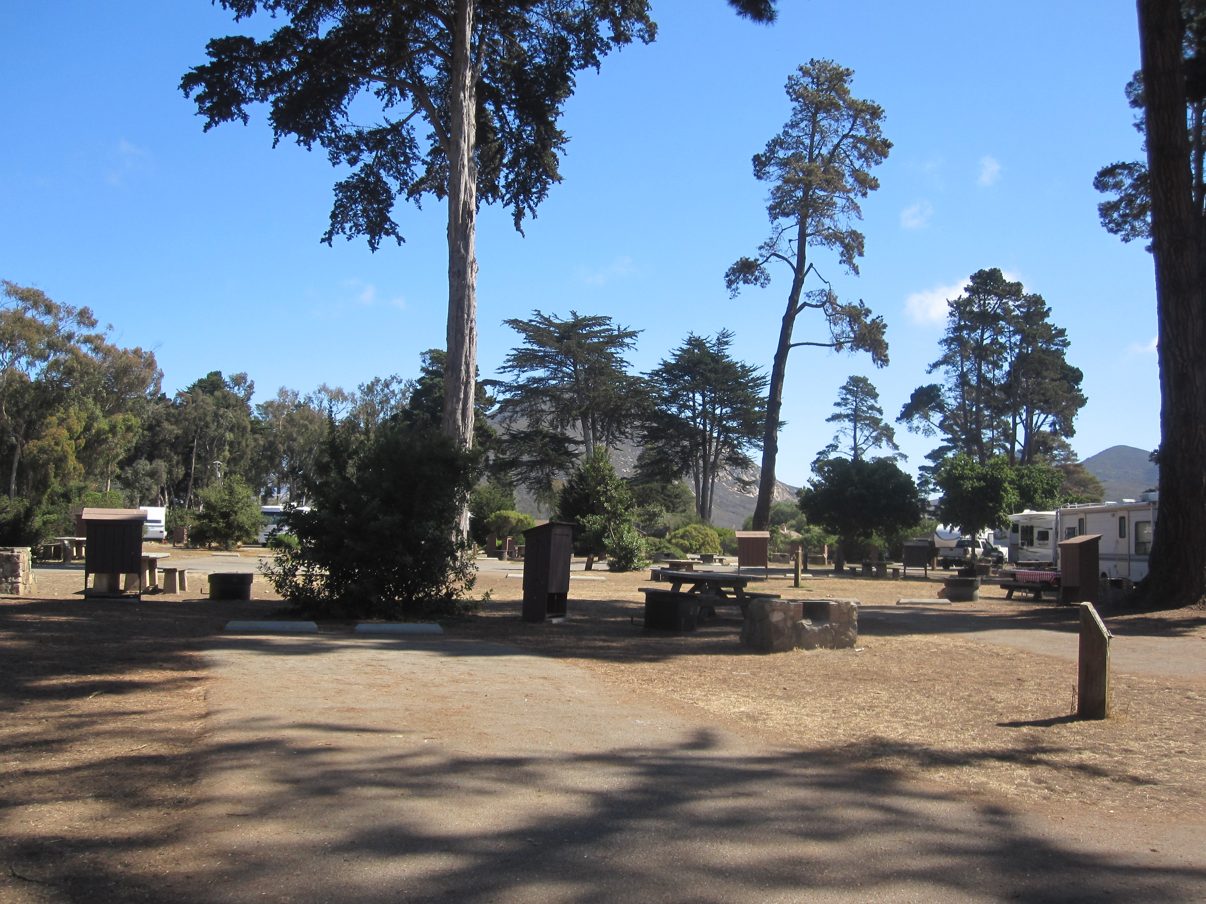
After following the signs to the campground, I found a campsite near the shower building and paid the fee at the office. I ate supper at the picnic table. Since I planned to car camp that night, set up was minimal. After arranging my sleeping gear in the car, Pippy and I took a walk through the grounds.
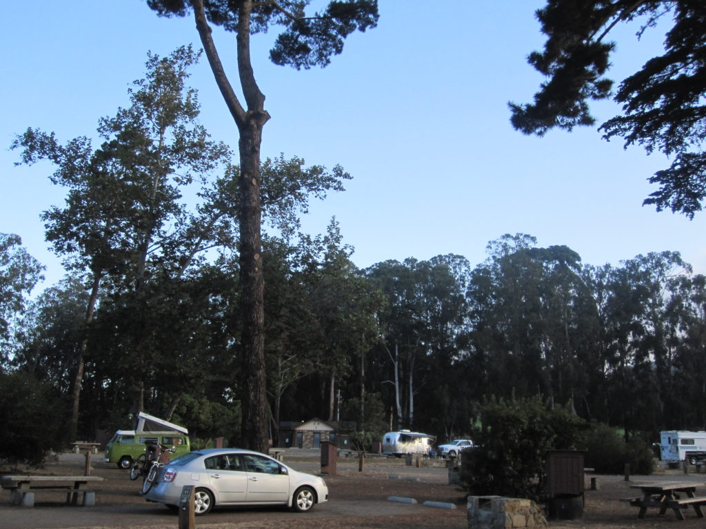
The campground was beautiful! Tall Cyprus trees stood throughout the dry, brown grounds .I admired these majestic trees for awhile as they stood against the night sky. Since it was the off-season, the campground had several vacant sites that night. I sat outside for awhile to relax and enjoy the mild evening temperature before going to bed.
When morning arrived, I hiked around the campground for a second time with my dog, Pippy. At this moment, I observed the sunrise through the trees as the clouds started to dissipate. It had been cloudy when I woke up. With the sun shining, I could get clearer photos than when the clouds were present.
Museum of Natural History
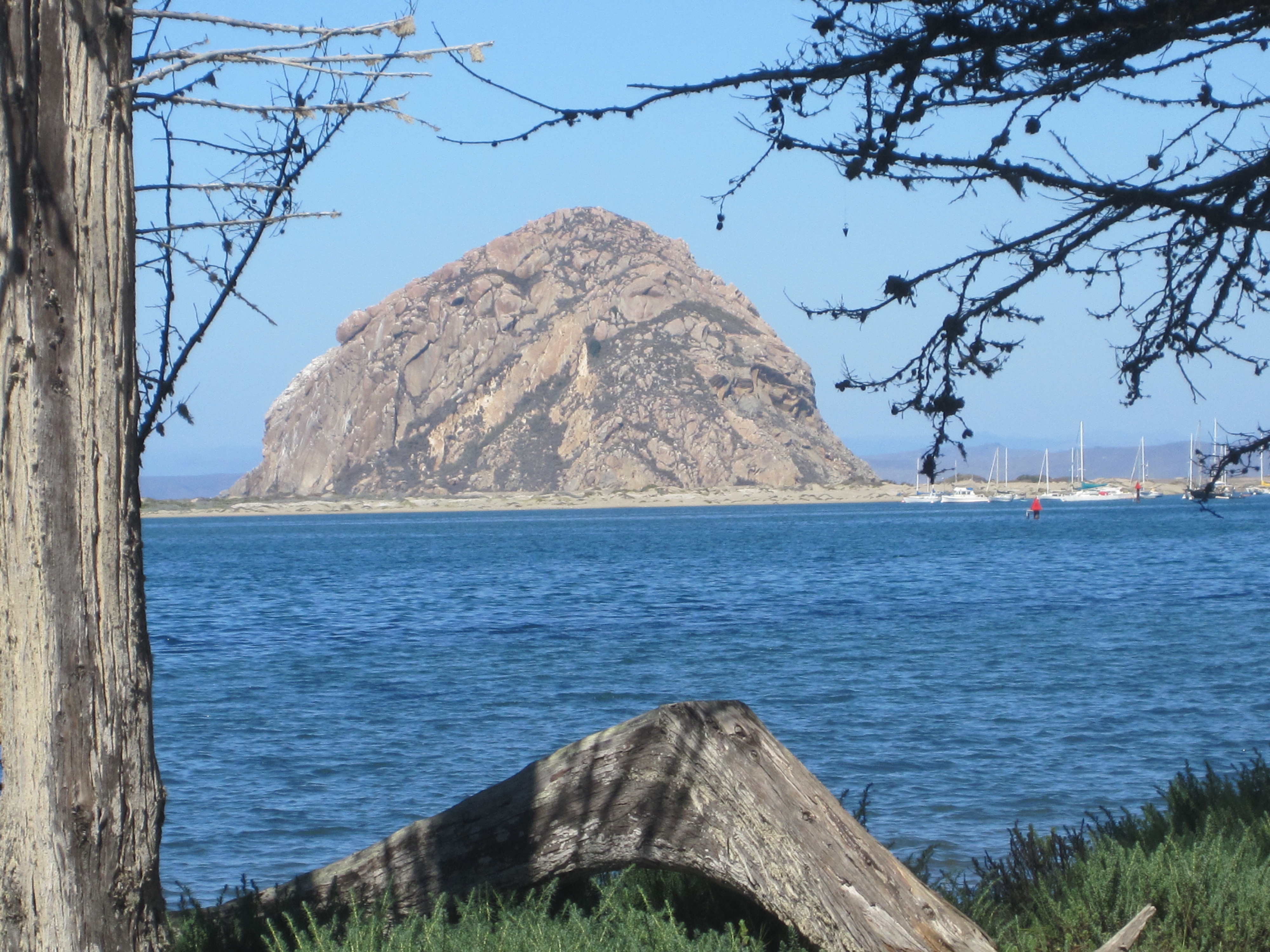
Shortly after my walk, I left the campground. My first stop for the day was the Morro Bay Museum of Natural History. This museum is located on top of a hill inside Morro Bay State Park. From the museum, Morro Rock is visible as well as the bay and the sand dunes.
The Morro Bay Museum of Natural History opened in 1962 and contains several interactive exhibits of the natural habitat of the area. These exhibits show how natural forces affect Earth’s environment and all life. Additionally, the exhibits educate museum visitors about the natural history of the area. This includes geology, erosion, tidal forces, how human beings impact the land, as well as ways to preserve the environment.
There are special programs, including hikes, exhibits, and talks held throughout the year about natural and cultural phenomenon that occur in nature. The view of the bay and Morro Rock from the museum is amazing.
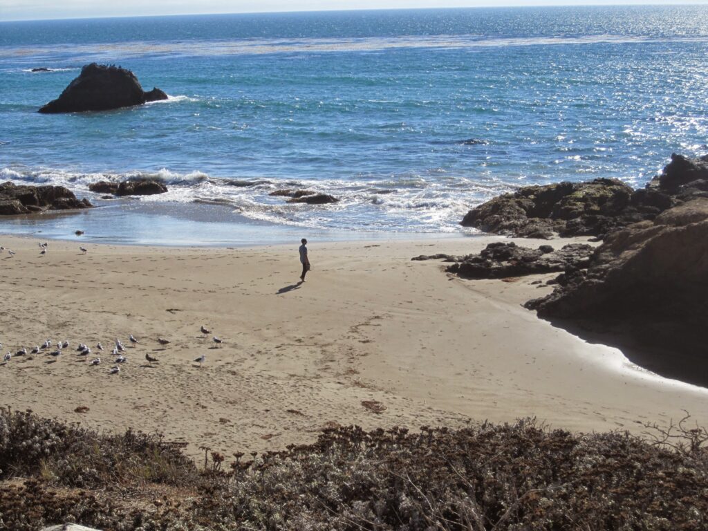
Exploring Morro Rock
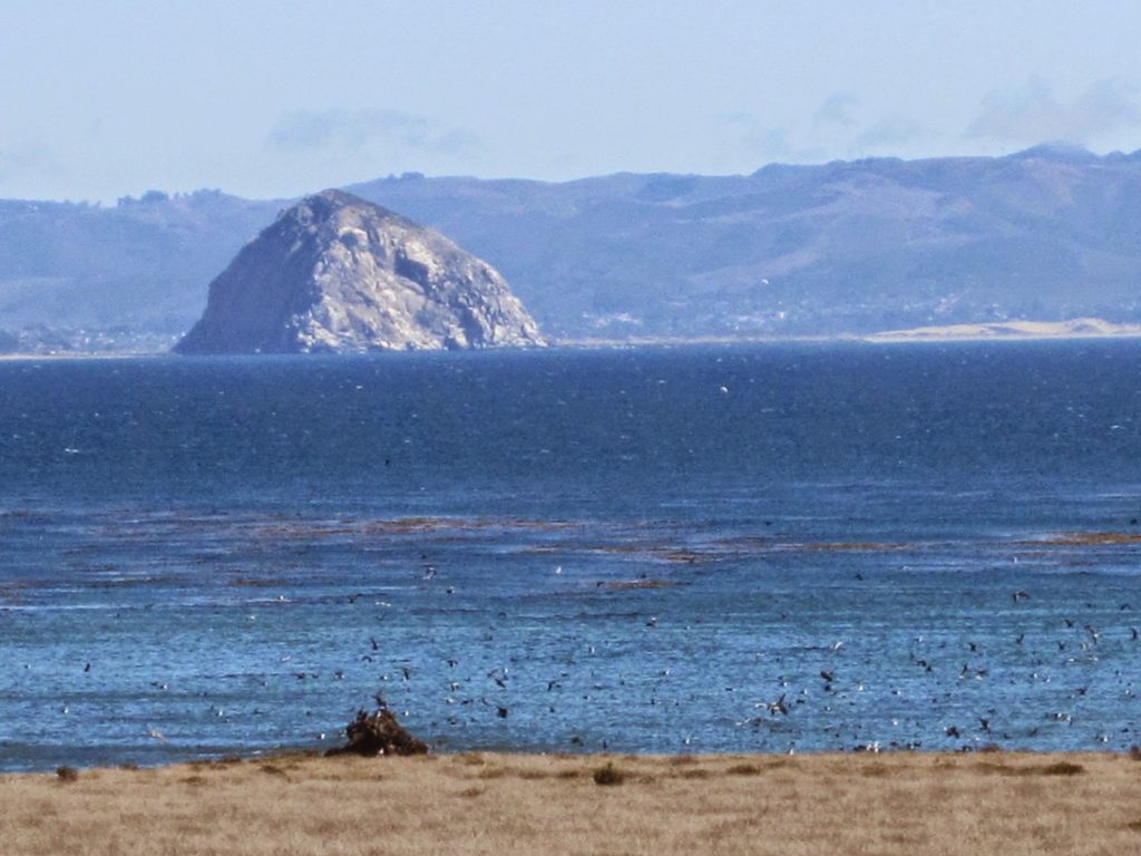
My first spectacular sight on this journey is Morro Rock. This rock protruded above the ground in the distance and fascinated me. When I left Morro Bay State Park and the Morro Bay Museum of Natural History, I proceeded to drive to Morro Rock.
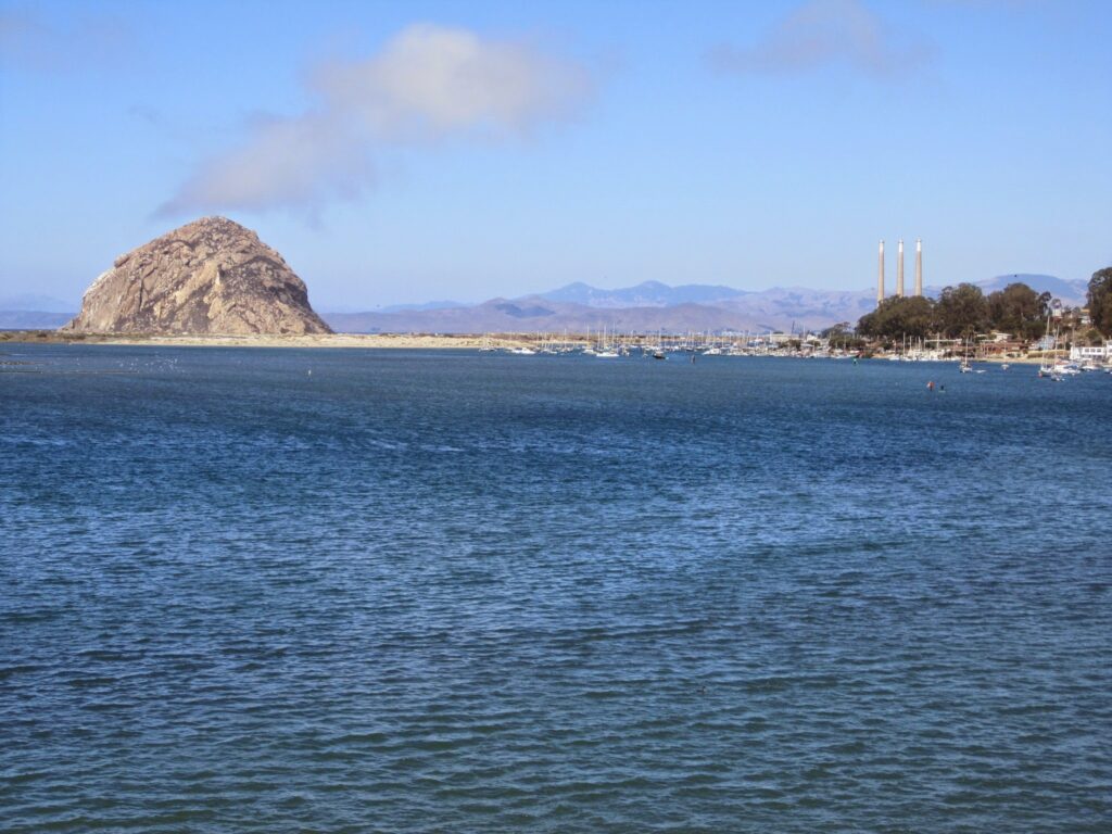
The 576-foot tall Morro Rock consists of a volcanic plug (also called a volcanic neck), which was created when magna hardened within the vent of an active volcano. Morro Rock formed over 23 million years ago. It is the shortest of the nine volcanic peaks in San Luis Obispo County, often referred to as “nine sisters”. Originally, Morro Rock was an island; however, today it is connected to the mainland by a causeway. In addition, Morro Rock is protected through the Morro Rock State Preserve. It is a National Historic Landmark.
Peregrine Falcon
Morro Rock is a nesting site for peregrine falcons. When I arrived, I parked the car near the end of the street close to the rock. A man had a telescope set up to view a peregrine falcon nest near the top of Morro Rock. Since I had not seen a peregrine falcon before, I took him up on his offer to look through the telescope to see it. What a beautiful sight!
The telescope was magnified enough that I could see the blue color of the peregrine falcon’s back and the white of the chest area. I didn’t see the black bars in the white area of its chest because it was so far away, but I did spot the yellow patch next to the bird’s beak.
After research, I learned that peregrine falcons build nests on tall structures, including cliffs, skyscrapers, and water towers. They catch birds while in the air in a swift move called a stoop. In some areas, they eat pigeons and ducks, as well. Additionally, these birds have been an endangered species in the 20th century, but the population has recovered due to recovery efforts by environmentalists and others. One reason this bird was an endangered bird is because of poisoning from pesticides used to kill weeds. I learned this information from Raptor Resource Project in northeast Iowa, where there have been many efforts to increase the population of peregrine falcons.
Morro Bay and Pacific Ocean
After this, I drove back to the parking lot near the entrance and found a parking spot. From this area, a person can visit the beach on the bay side of the road, as well as the beach on the other side of the road, which is the Pacific Ocean side.
First, I walked to the beach on the bay side of the road. The water was calm on this side and a vivid blue color.
Next, I stepped across the rocky area on the other side of the parking lot and strolled through the sand on the ocean side of Morro Rock. Here, I took my shoes off and walked into the ocean. The waves moved back and forth over my feet. The water was cold so I only stayed a few minutes. However, I became mesmerized when the ocean waves moved back and forth over my feet even though it was chilly.
Thus, I could have stayed at this location for several hours, but it was time to continue my journey north to find the next spectacular view, the elephant seals.
The Drive North on the Pacific Coast Highway
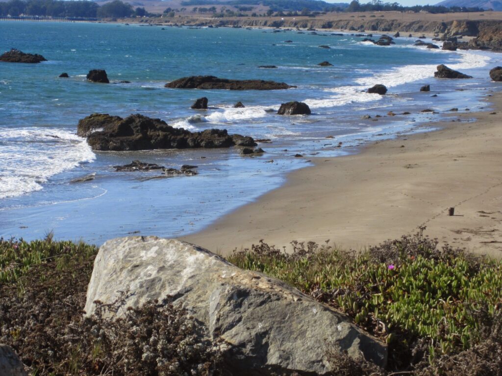
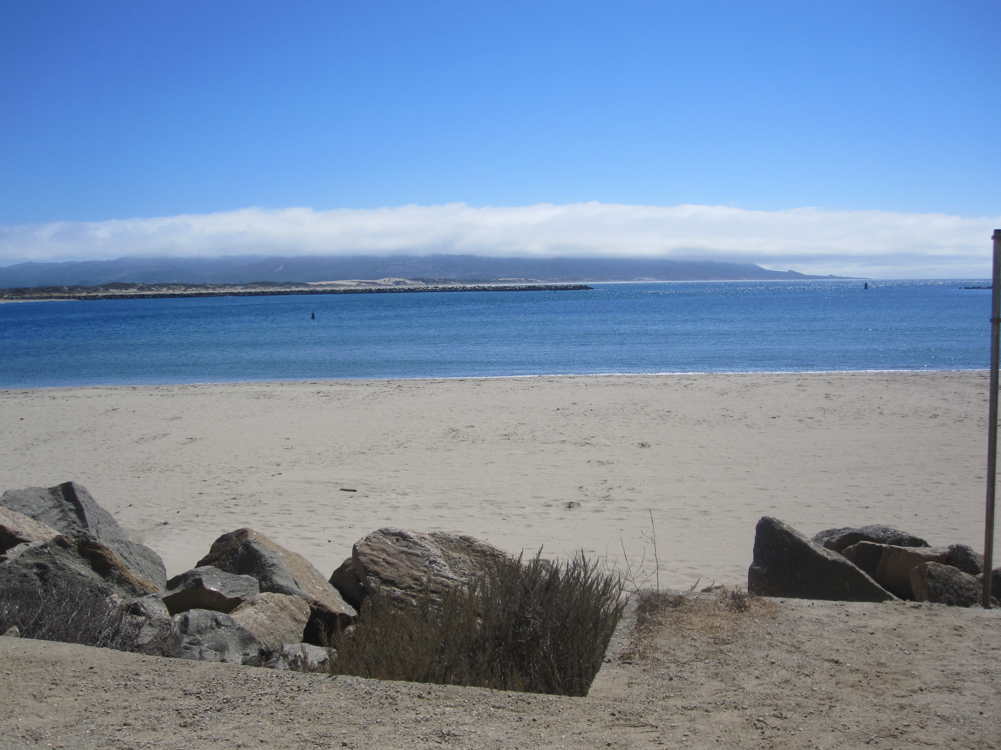
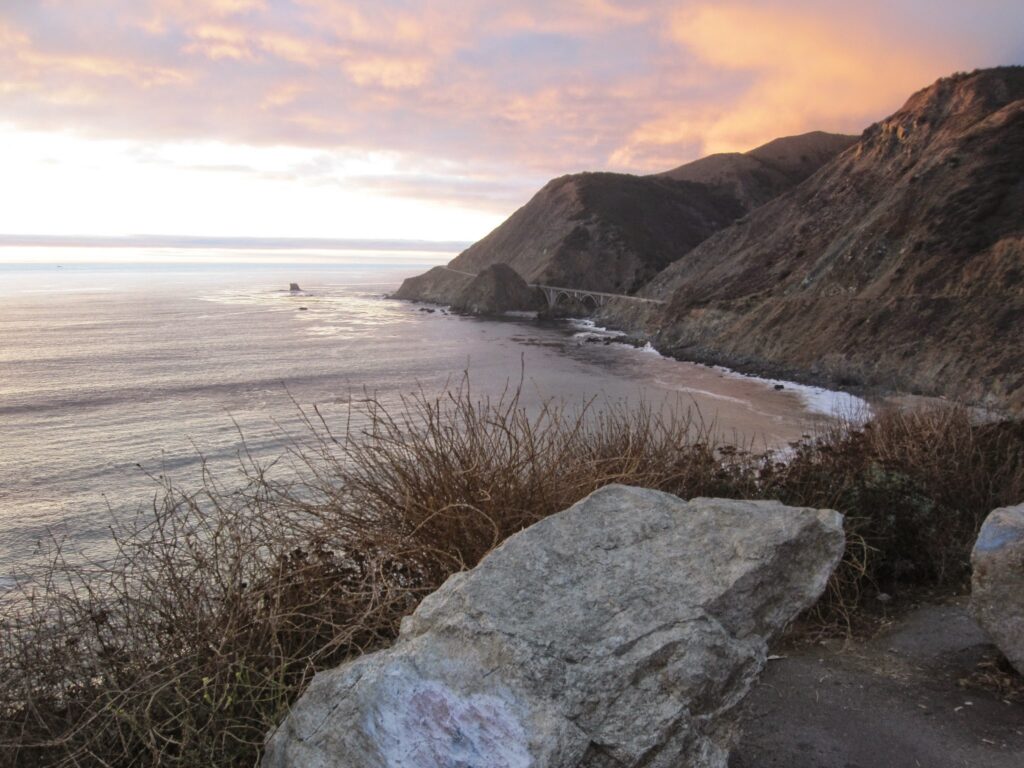
As I continued to drive north on the Pacific Coast Highway, the road took me higher and higher above the ocean. I stopped at several scenic overlooks along the way and admired the beauty of each unique view as ocean waves crashed against the shoreline. The sun shone on the bright blue ocean water.
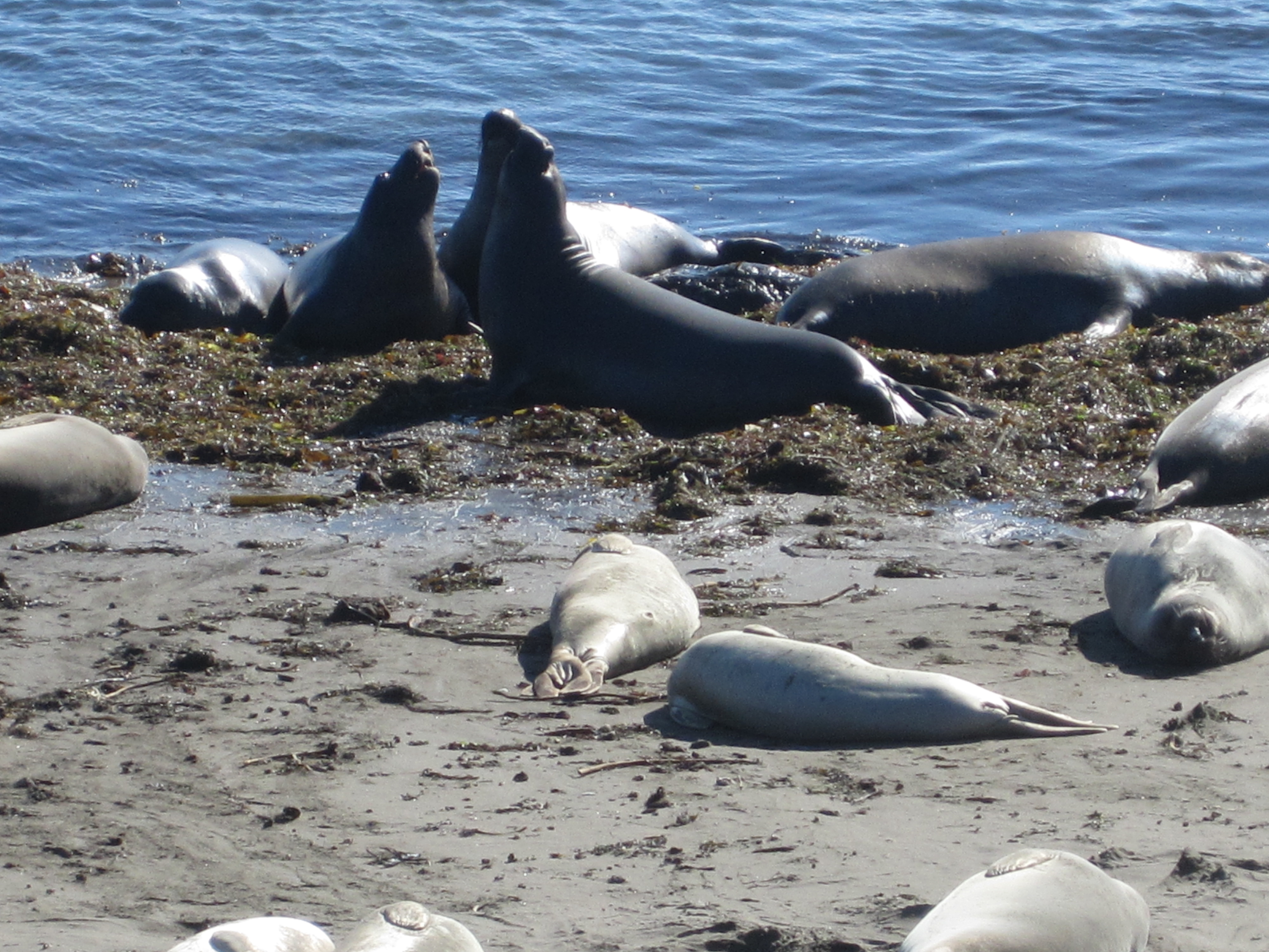
Elephant Seals
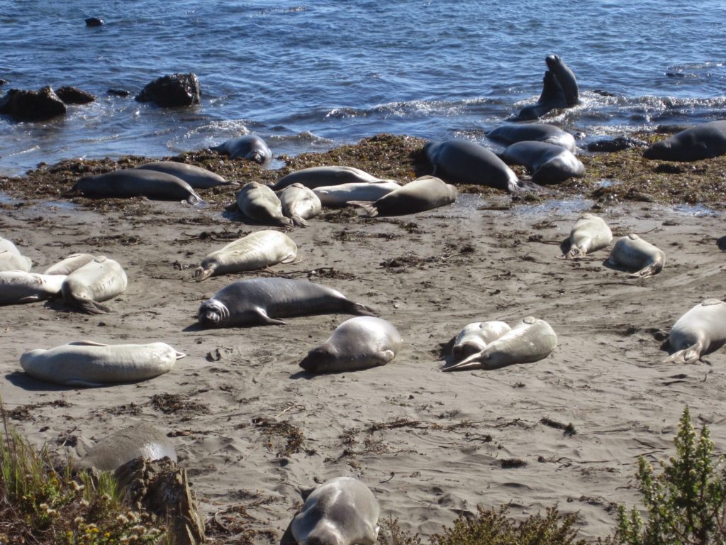
At last, I found the second impressive view on this stretch of Highway 1: the Elephant Seal Viewing area. My friends advised me to stop at this particular overlook. I looked forward to seeing the elephant seals ever since I heard this. The elephant seal viewing area is at the Piedras Blancas Rookery in San Simeon, California. This viewing area is on Highway 1 (Pacific Coast Highway), seven miles north of San Simeon and is free to the public year-round.
From the parking lot, I walked to the board walk and spotted the elephant seals on the beach below. I viewed and admired the elephant seals for the next hour and walked as far as I could on the boardwalk to see them below. People are not allowed on the beach where the seals are.
It fascinated me to observe the seals playing with each other and slithering up and down as they moved around. At the same time, other seals lay on the beach sunning themselves. The seals entertained me as I watched them wriggle on their bellies to move around. Some even made a grunting sound.
For more information about elephant seals, go to the San Simeon visitor website elephant seal page here.
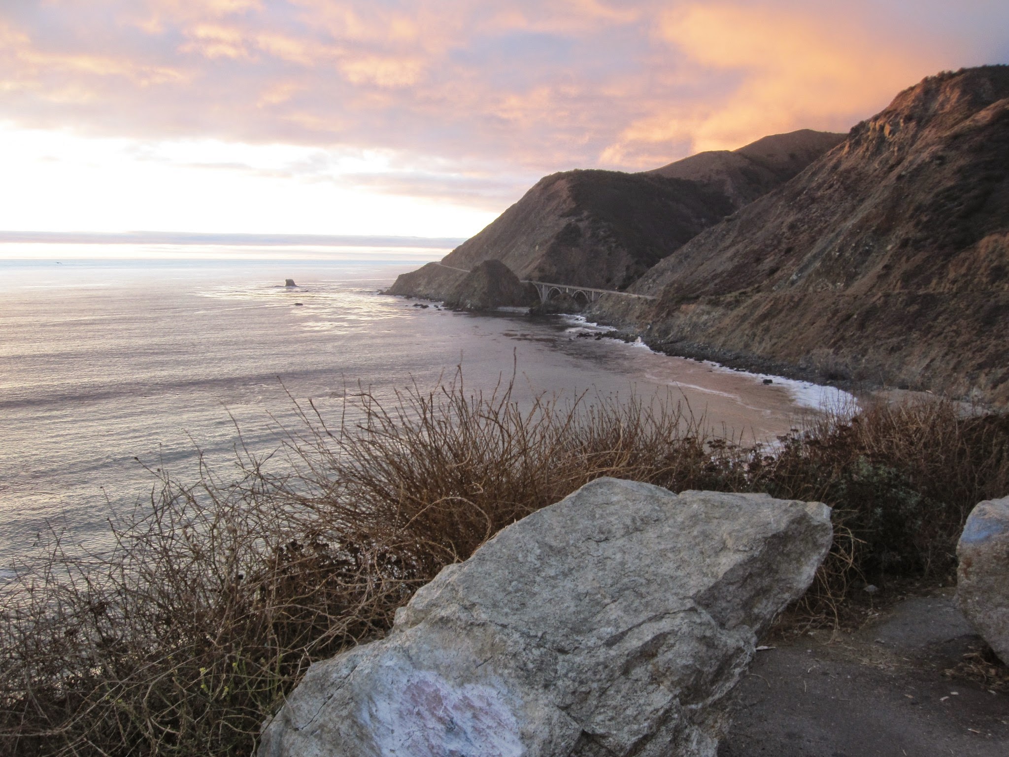
I continued to stop at every pullout to view the scenery, more so the closer it got to dusk. Each unique view of the ocean below mesmerized me more and more. Finally, I spotted the third spectacular view as I continued my journey north: the sunset over the ocean.
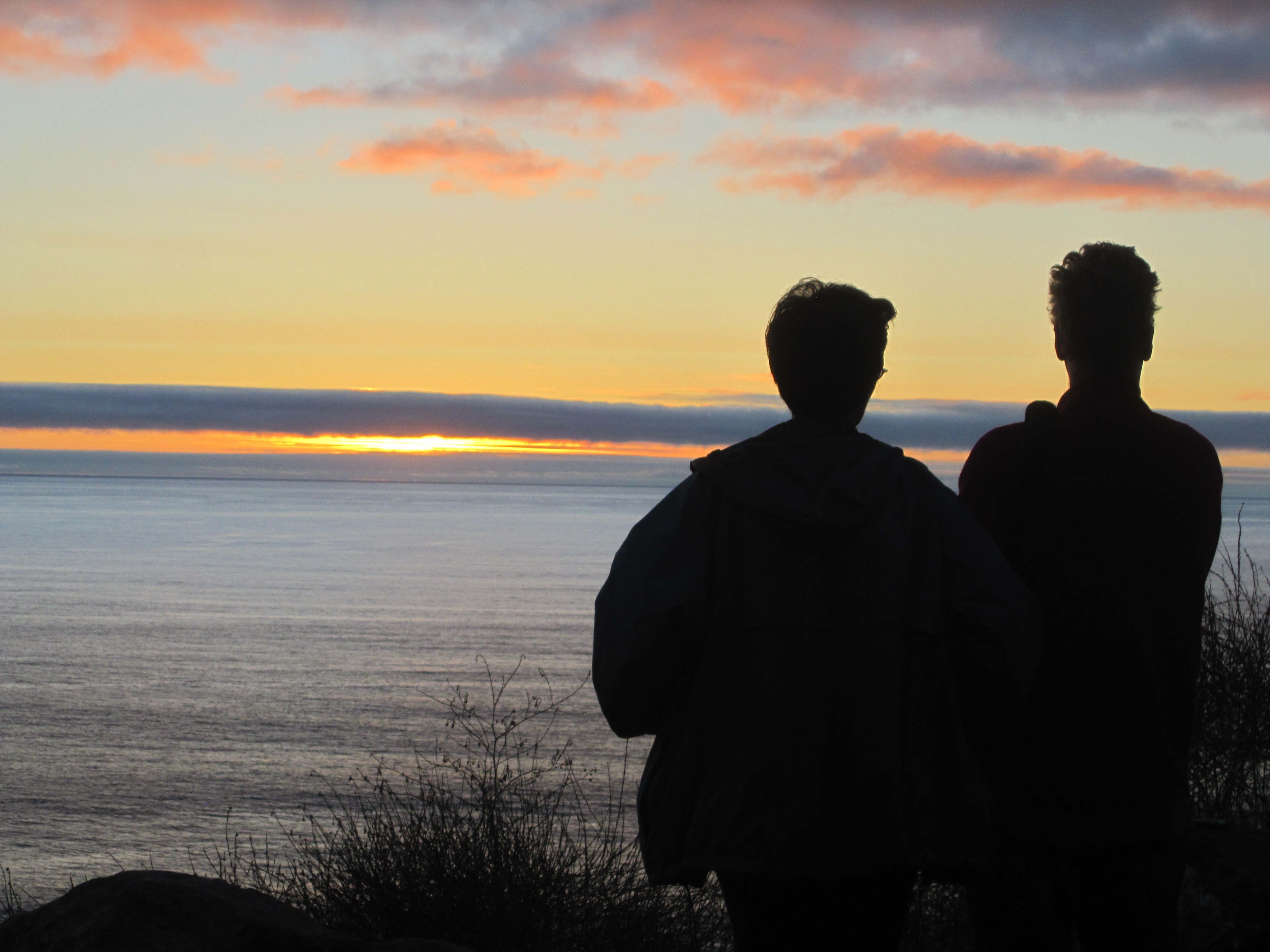
Sunset Over the Ocean
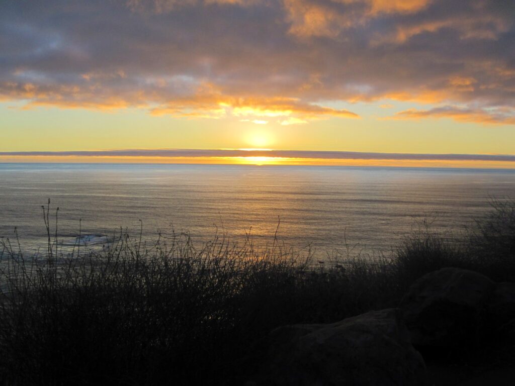
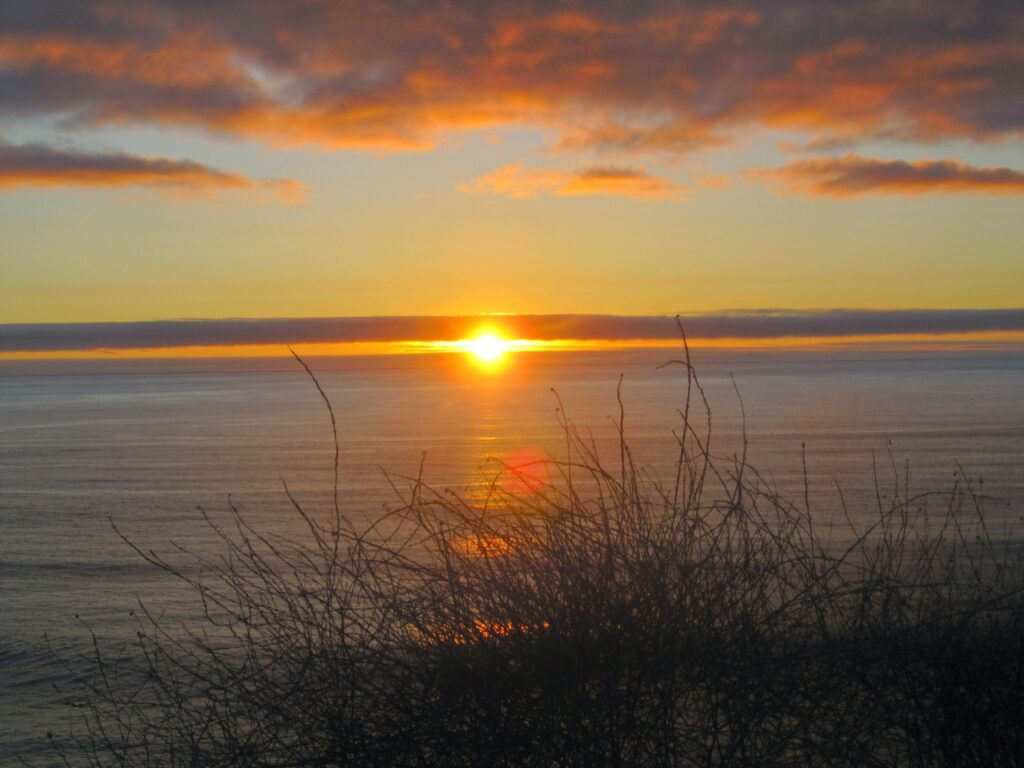
Soon, the sun lowered in the sky. I pulled over at Los Padres National Forest Pullout – Willow Creek to see the hypnotizing view over the ocean just as it was about to reach the horizon. Ocean waves flowed peacefully below the setting sun as the red and orange hues reflected brilliantly over the water. I watched in awe! As the sun lowered and descended close to the horizon, the sun appeared to flatten. Then it disappeared, leaving an amazing color pattern of orange and yellow blazing in the western sky. Sunsets over the ocean can be the most picturesque sunsets. This sunset was no exception! It was gorgeous!
At last, darkness fell upon the earth. Yellow, red, and orange colors disappeared into the horizon. It was time to leave this spot and continue to drive north. The drive into the darkness took me past Monterey to the town of Marina, where I began my journey east and said “good-bye” to the ocean. It was time to find a place to spend the night and begin my journey east to Iowa the next morning.
Final Thoughts About the Pacific Coast Highway
In conclusion, the drive along the section of the Pacific Coast Highway in California from Lompoc to Marina was one of the most scenic routes I have ever driven. Additionally, the endless ocean views captivated my senses and left me awestruck as I looked out into the endless body of clear, blue water. Breathtaking scenery, complete with a magnificent sunset left me wanting more.
Unfortunately, time didn’t allow me to continue my journey on this highway through northern California. However, it definitely is on my bucket list to drive through northern California on the Pacific Coast Highway. I highly recommend visiting this gem of a highway the next time you visit California. You will enjoy the scenery as much as I did. What a gorgeous country we live in!
Further Reading
Read about my other outdoor adventures, including my trip to Tulip Time in Pella, Iowa. Also, I hiked a scenic trail at Swiss Valley Nature Preserve in Eastern Iowa, as well as visited Yellowstone National Park.